Personal project. This basically consists of choosing anything you want to focus on. What you as a design would like to focus on.
I have been thinking and doodling a lot in information graphs and information about what I do on a daily basis. This lead to to decide on creating diagrams, lists, collecting receipts, etc about my everyday life in another country.
But after beginning to doing so, I felt like I wanted to include so much more than I believe an informational graph could show. I wanted to include my UK living in diagrams, but also add photos, thoughts, writings, and just things that I feel our entertaining and give an idea about my current location.
This once informational manuel is now turning into an editorial project. I first begin to think about my everyday routine then break sections into categories, allowing me to continue to gather further information in these areas. Like illustrations, photos, and writings. This will allow me to obtain more information in these areas, and really focus on the details.
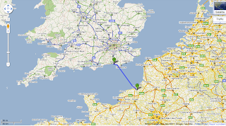
Below is just one of the many tests I have done when dealing with location and distances. Showing the distance of about 200 miles in the US (Kansas City) and the distances in the UK (Brighton). This was eye opening. You know of course the US is huge, but when comparing it to your current location and the place you once lived, really makes you think. I then thought about the distances I travel in the UK and the distances I travel in the US. Very similar, but everything is much closer together here in Brighton, compared to Kansas City. Realizing also that I travel about the same amount of distances, but using a car in the US, rather than by foot.
Mapping out my common routes of both places*, I thought looking into psychogeograhy would be an interesting take to include. Beginning by mapping the routes out and combining the paths. Analyzing locations that would be visited if I was to be using my daily route in Kansas City to the geography of Brighton. Also separating them in different areas, and placing them on a graph paper and overlaying places of interest. (pictures to upload)
*realizing that America is like one giant grid
More to come. Layouts, photos, and more.


No comments:
Post a Comment